Spotlight
Media
Publications:
Documents:
Biography
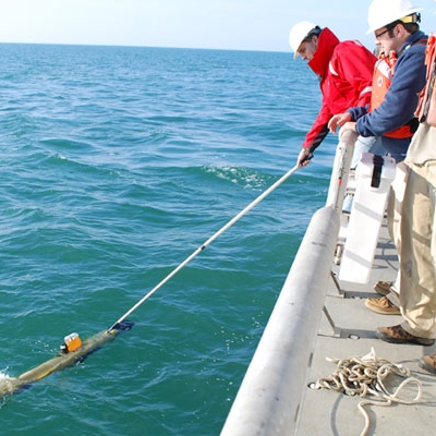
Arthur Trembanis' research focuses on understanding how waves and currents shape the beach and seabed. He utilizes underwater robots to explore the sea and examine what lies on the ocean floor. Exploration sites include shipwrecks, artificial reefs, and mesophotic corals.
Trembanis develops new autonomous underwater robot technologies and data visualization techniques. Expeditions include sites throughout the Caribbean (Bonaire, Cayman Islands, Bermuda, Saba), throughout the Mediterranean and Agean seas, the Black Sea, Delaware Bay, New Zealand, Bikini Atoll amongst many others.
Much of Trembanis's recent work involves developing and utilizing machine learning (artificial intelligence) to understand coastal dynamics and imagery analysis. A major focus is on helping the build and expand the Blue Tech portion of the larger Blue Economy which involves partnering with commercial, educational, and agency stakeholders in building autonomous robots and the workforce to operate them in challenging marine environments.
Industry Expertise (2)
Research
Education/Learning
Areas of Expertise (8)
Seafloor Mapping
Coastal Erosion and Morphodynamics
Hurricanes and Nor'easters
Underwater Robots
Shipwrecks
Artificial Reefs
Ripples
Mesophotic Coral Ecosystems
Media Appearances (8)
Searching for 'The Goonies' pirate ship | UDaily
University of Delaware online
2022-07-15
For a week in June, University of Delaware professor Art Trembanis and members of his lab joined SEARCH2O, the maritime archeology branch of SEARCH Inc., to conduct underwater mapping of possible locations of the ship off the coast of Oregon.
‘Not a drill’: Delaware robot boats are put to the test when a tugboat sinks
Technical.ly online
2021-01-04
Art Trembanis, associate professor marine science and policy at UD’s Hugh R. Sharp campus in Lewes, got the call the day Miss Aida went down as he was out on the water of Indian River Bay on a mapping project.
'Nuclear battlefield' revealed as scientists map Bikini Atoll test craters and sunken warships
Fox News online
2019-12-10
The study, authored by Arthur Trembanis, Ph.D., an associate professor at the University of Delaware and doctoral student Carter DuVal, describes the site as “the world's first simulated nuclear battlefield.”
Seafloor scar of Bikini A-bomb test still visible
BBC News online
2019-12-10
"Bikini was chosen because of its idyllic remoteness and its large, easily accessible lagoon," explains survey team-leader Art Trembanis from the University of Delaware.
Hyper-Detailed Maps Reveal Seafloor Craters From Bikini Atoll Nuclear Tests
Gizmodo online
2019-12-11
This research was an opportunity to “really illuminate the story of nuclear testing in ways that it hadn’t and couldn’t have been done before,” Art Trembanis, associate professor at the University of Delaware, told Gizmodo by phone.
Researchers find more "ghost" crab pots in Delaware Inland Bays than expected
Delaware Public Media online
2019-05-16
UD Associate Professor of Oceanography Art Trembanis and Delaware Sea Grant Coastal Ecology Specialist Kate Fleming made the trip in February. Each says they were surprised by how many pots they found.
Wreck of US WWII B-24 bomber discovered 74 years after it plunged into the sea off Bermuda
Fox News online
2019-03-28
“Finding the wreckage of the plane was a simultaneously thrilling and solemn moment,” the project's team leader, University of Delaware associate professor Art Trembanis, told Fox News via email.
Shipwreck mystery solved | UDaily
University of Delaware online
2012-08-08
“It was not something we expected to be as old as it was,” said Arthur Trembanis, associate professor of oceanography and geological sciences in the College of Earth, Ocean, and Environment.
Articles (5)
Hydrodynamics and Sediment-Transport Pathways along a Mixed-Energy Spit-Inlet System: A Modeling Study at Chincoteague Inlet (Virginia, USA)
Journal of Marine Science and Engineering2023 Tidal-inlet systems are dynamic features that respond to short-term (e.g., storms) and longer-term processes (e.g., sea-level rise, changes in tidal prism). The Chincoteague Inlet system, located along the northern Eastern Shore of Virginia (USA), is a dynamic coastal complex that experiences rapid change associated with sediment redistribution and a shifting inlet throat due to the southern elongation of adjacent Assateague Island.
Deep learning for pockmark detection: Implications for quantitative seafloor characterization
Geomorphology2023 Occurring globally, pockmarks are seafloor depressions associated with seabed fluid escape. Pockmark ubiquity and morphologic heterogeneity result in an irregular seafloor that can be difficult to quantitatively describe. To address this challenge, we test the hypothesis that deep-learning based object detection and segmentation can be used to develop data-driven models for pockmark identification and characterization.
Development and Field Testing of an Optimal Path Following ASV Controller for Marine Surveys
IEEE2022 Marine autonomous vehicles deployed to conduct marine geophysical surveys are becoming an increasingly used asset in the commercial, academic, and defense industries. However, the ability to collect high-quality data from applicable sensors is directly related to the robustness of vehicle motion caused by environmental disturbances.
Mechanisms and Rates of Sand Bypassing along a Rapidly Evolving Inlet-Spit System
AGU Fall Meeting 20212021 Chincoteague Inlet and the proximal barrier islands of Chincoteague, Assateague, and Wallops comprise a dynamic coastal complex that is experiencing rapid change associated with sediment redistribution (erosion and deposition) and a shifting tidal inlet and flood- and ebb-tidal delta sands. Understanding the morphodynamic and sediment-transport processes and underlying hydrodynamic and geomorphic controls within this rapidly evolving inlet spit system is critical to developing a regional sediment management plan that is protective of the Town of Chincoteague, southern Assateague Island, and the Mid-Atlantic Regional Spaceport and the NASA flight Facility on Wallops Island.
Developing a CNN for automated detection of Carolina bays from publicly available LiDAR data
Authorea Preprints2020 For over a century, the enigmatic Carolina bays have captivated geologists and spurred contentious debate on their origin. These circular to ovate and shallow (median diameter of 222 m, median depth of 2.17 m, median area of 26,249 sq. m) depressions span the Atlantic Coastal Plain (ACP) from northern Florida to southern New Jersey, with total counts ranging between 10,000 and 500,000. Using 1 meter gridded, 1.7 km by 1.7 km LiDAR digital elevation models (DEMs) of Delaware as training images, a convolutional neural network (CNN) was trained to detect Carolina bays.
Accomplishments (1)
Fulbright Fellowship (professional)
1998
Education (3)
William & Mary: PhD, Marine Science 2004
University of Sydney: Fulbright, Coastal Geology 1999
Duke University: BS, Geology, Oceanography 1998
Affiliations (4)
- Center for Autonomous and Robotic Systems : Deputy Director, 2020
- Mechanical Engineering (UD) : Affiliate Faculty Member
- Program for the Study of Developed Shorelines (WCU) : Affiliate Faculty Member
- Center for Coastal and Ocean Mapping (UNH) : Affiliate Faculty Member
Links (4)
Event Appearances (1)
Ocean Exploration in the Age of Robotics
(2019) TedX Wilmington
Social