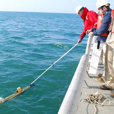
Arthur Trembanis

Professor, Marine Science and Policy University of Delaware

  • Newark DE

Prof. Trembanis research focuses on understanding beaches for resilience and mapping the seafloor using robots to develop the Blue Economy.

Contact

University of Delaware

View more experts managed by University of Delaware

Spotlight

2 min

Exploring the Depths: How AI is Revolutionizing Seafloor Research

In recent years, there has been a significant shift in the way seafloor research is conducted, all thanks to the groundbreaking advancements in artificial intelligence (AI) technology. The depths of our oceans have always been a mystery, but with the use of AI, scientists and researchers are now able to explore and uncover the hidden secrets that lie beneath the surface. With funding from the Department of Defense, University of Delaware oceanographer Art Trembanis and others are are using artificial intelligence and machine learning to analyze seafloor data from the Mid-Atlantic Ocean. The goal is to develop robust machine-learning methods that can accurately and reliably detect objects in seafloor data.  “You can fire up your phone and type dog, boat or bow tie into a search engine, and it's going to search for and find all those things. Why? Because there are huge datasets of annotated images for that,” he said. “You don't have that same repository for things like subway car, mine, unexploded ordnance, pipeline, shipwreck, seafloor ripples, and we are working to develop just such a repository for seabed intelligence.” Trembanis is able to talk about this research and the impact it could have on our day to day lives. He can be contacted by clicking his profile.  “You have commercial companies that are trying to track pipelines, thinking about where power cables will go or offshore wind farms, or figuring out where to find sand to put on our beaches,” said Trembanis. “All of this requires knowledge about the seafloor. Leveraging deep learning and AI and making it ubiquitous in its applications can serve many industries, audiences and agencies with the same methodology to help us go from complex data to actionable intelligence.” He has appeared in The Economic Times, Technical.ly and Gizmodo.

Arthur Trembanis

1 min

With 'Oppenheimer' still dominating box office, expert shares findings from visit to nuclear testing site in the Pacific

The box office smash "Oppenheimer" captured imagination of a new generation of Americans who never knew a world without nuclear weapons. University of Delaware professor Art Trembanis can provide a unique perspective on this topic as well as the history of nuclear weapon testing. Four years ago, he was part of a team that visited the Bikini Atoll in the Pacific Ocean's Marshall Islands, where the United States conducted a series of nuclear weapons tests in the 1940s and 1950s that sank warships, tanks and other vehicles as part of a simulated nuclear battlefield. He realized that if he had been in that spot during any one of those tests, he would have been engulfed in a humongous atomic mushroom cloud. Trembanis' team was tasked with conducting an underwater mapping effort to locate and characterize the 12-ship ghost fleet that sits 180 feet deep at the bottom of Bikini Lagoon. He is available for interviews and can be contacted by clicking on his profile photo or via his ExpertFile profile.

Arthur Trembanis

Biography

Arthur Trembanis' research focuses on understanding how waves and currents shape the beach and seabed. He utilizes underwater robots to explore the sea and examine what lies on the ocean floor. Exploration sites include shipwrecks, artificial reefs, and mesophotic corals.

Trembanis develops new autonomous underwater robot technologies and data visualization techniques. Expeditions include sites throughout the Caribbean (Bonaire, Cayman Islands, Bermuda, Saba), throughout the Mediterranean and Agean seas, the Black Sea, Delaware Bay, New Zealand, Bikini Atoll amongst many others.

Much of Trembanis's recent work involves developing and utilizing machine learning (artificial intelligence) to understand coastal dynamics and imagery analysis. A major focus is on helping the build and expand the Blue Tech portion of the larger Blue Economy which involves partnering with commercial, educational, and agency stakeholders in building autonomous robots and the workforce to operate them in challenging marine environments.

Industry Expertise

Research
Education/Learning

Areas of Expertise

Seafloor Mapping
Coastal Erosion and Morphodynamics
Hurricanes and Nor'easters
Underwater Robots
Shipwrecks
Artificial Reefs
Ripples
Mesophotic Coral Ecosystems

Media Appearances

Searching for 'The Goonies' pirate ship | UDaily

University of Delaware  online

2022-07-15

For a week in June, University of Delaware professor Art Trembanis and members of his lab joined SEARCH2O, the maritime archeology branch of SEARCH Inc., to conduct underwater mapping of possible locations of the ship off the coast of Oregon.

View More

‘Not a drill’: Delaware robot boats are put to the test when a tugboat sinks

Technical.ly  online

2021-01-04

Art Trembanis, associate professor marine science and policy at UD’s Hugh R. Sharp campus in Lewes, got the call the day Miss Aida went down as he was out on the water of Indian River Bay on a mapping project.

View More

'Nuclear battlefield' revealed as scientists map Bikini Atoll test craters and sunken warships

Fox News  online

2019-12-10

The study, authored by Arthur Trembanis, Ph.D., an associate professor at the University of Delaware and doctoral student Carter DuVal, describes the site as “the world's first simulated nuclear battlefield.”

View More

Show All +

Articles

Hydrodynamics and Sediment-Transport Pathways along a Mixed-Energy Spit-Inlet System: A Modeling Study at Chincoteague Inlet (Virginia, USA)

Journal of Marine Science and Engineering

2023

Tidal-inlet systems are dynamic features that respond to short-term (e.g., storms) and longer-term processes (e.g., sea-level rise, changes in tidal prism). The Chincoteague Inlet system, located along the northern Eastern Shore of Virginia (USA), is a dynamic coastal complex that experiences rapid change associated with sediment redistribution and a shifting inlet throat due to the southern elongation of adjacent Assateague Island.

View more

Deep learning for pockmark detection: Implications for quantitative seafloor characterization

Geomorphology

2023

Occurring globally, pockmarks are seafloor depressions associated with seabed fluid escape. Pockmark ubiquity and morphologic heterogeneity result in an irregular seafloor that can be difficult to quantitatively describe. To address this challenge, we test the hypothesis that deep-learning based object detection and segmentation can be used to develop data-driven models for pockmark identification and characterization.

View more

Development and Field Testing of an Optimal Path Following ASV Controller for Marine Surveys

IEEE

2022

Marine autonomous vehicles deployed to conduct marine geophysical surveys are becoming an increasingly used asset in the commercial, academic, and defense industries. However, the ability to collect high-quality data from applicable sensors is directly related to the robustness of vehicle motion caused by environmental disturbances.

View more

Show All +

Accomplishments

Fulbright Fellowship

1998

Education

William & Mary

PhD

Marine Science

2004

University of Sydney

Fulbright

Coastal Geology

1999

Duke University

BS

Geology, Oceanography

1998

Affiliations

  • Center for Autonomous and Robotic Systems : Deputy Director, 2020
  • Mechanical Engineering (UD) : Affiliate Faculty Member
  • Program for the Study of Developed Shorelines (WCU) : Affiliate Faculty Member
  • Center for Coastal and Ocean Mapping (UNH) : Affiliate Faculty Member

Event Appearances

Ocean Exploration in the Age of Robotics

(2019) TedX Wilmington