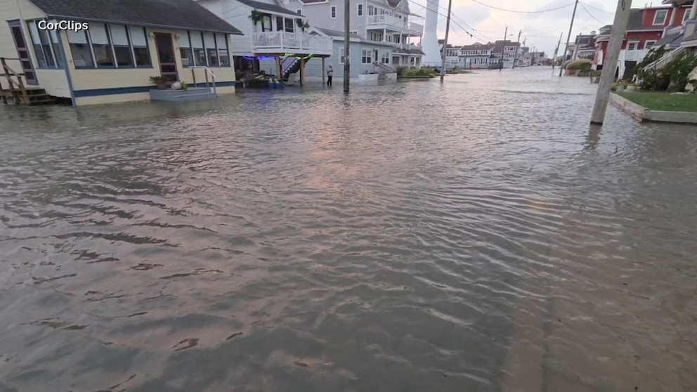
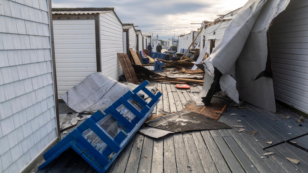
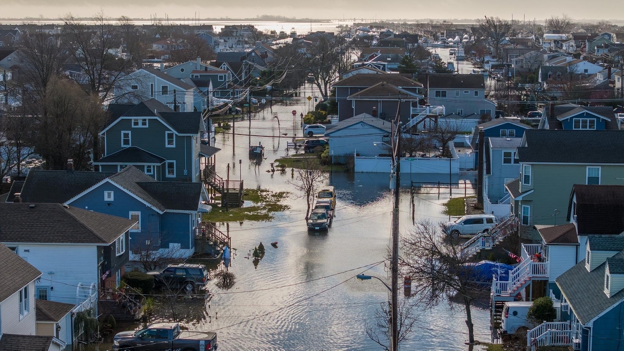
A rare September nor’easter is developing along the East Coast, bringing the potential for heavy rain, strong winds, dangerous surf, coastal flooding and beach erosion from the Mid-Atlantic into the Northeast.
ABC News reports that the storm is expected to intensify off the coast this week, although its ultimate impacts will depend heavily on its track and how close it comes to shore.
The storm arrives as El Niño continues to strengthen in the Pacific. NOAA's Climate Prediction Center says there is now a greater than 90% chance of a very strong El Niño this fall and winter, adding another important element to questions about what kind of weather the Northeast could experience in the months ahead.
Jase Bernhardt, PhD, associate professor of geology, environment and sustainability and director of Hofstra University’s meteorology program, can discuss the developing nor’easter, the factors influencing its track and intensity, and how strong El Niño conditions could shape weather patterns across Long Island and the Northeast. View his profile Covering the storm? We can help.
Bernhardt can provide perspective on:
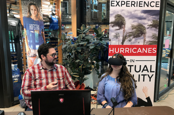
Why a September nor’easter is unusual and what is driving this week's storm The potential for strong winds, coastal flooding, heavy rain and beach erosion Why small changes in a nor’easter's track can dramatically change local impacts How a strong El Niño can influence fall and winter weather patterns Whether the region could see more coastal storms later this fall and winter How residents should interpret and respond to severe-weather warnings Bernhardt's research also explores how people respond to warnings about dangerous weather. He has developed virtual reality simulations designed to demonstrate the risks associated with events including hurricanes, flash floods and snow squalls and to study whether immersive experiences can improve public response to severe-weather warnings.
To arrange an interview today, simply click on his profile below
·
1 min
After an EF1 tornado touched down in Atlantic Beach on August 20, Dr. Jase Bernhardt, associate professor of geology, environment, and sustainability, talked to Newsday about this rare occurrence.
Some parts of the country – particularly in the central United States – are more likely to have the atmospheric conditions required to form a tornado.
One key condition these cyclones require is “a clashing of contrasting air masses,” said Bernhardt. “We just don’t have the ingredients that are necessary. The water around the island tends to moderate the climate a bit.”
·
1 min
Jase Bernhardt, associate professor of geology, environment, and sustainability, was interviewed by Newsday about the increased risk of flash flooding on Long Island.
The article explains that flash flooding is caused by heavy rainfall in a short period. It’s often caused by thunderstorms in the summer, when there’s more moisture in the air than in cooler months. It can happen anywhere across the region, as opposed to storm surge flooding, which mostly impacts low-lying coastal areas.
Any change in the frequency of flash flooding on Long Island is also a function of the way water moves on the ground and ultimately of urbanization, Dr. Bernhardt said. “Poor drainage, sewer systems” and impervious surfaces like “parkways, parking lots” and other types of development all play a role.
Media
Biography
Jase Bernhardt is an associate professor in the Department of the Geology, Environment and Sustainability at Hofstra University and also director of the department's MA Sustainability program. At Hofstra, Jase instructs courses in sustainability, climate change, and meteorology and leads research in the area of severe weather warning communication. His research is currently being funded by the National Science Foundation and New York Sea Grant, the former a project to engage student teams in research, and the latter an initiative to improve rip current outreach to Long Island Latinx communities. Bernhardt's past research has been funded by the University Corporation for Atmospheric Research, New York Sea Grant, and Hofstra University, and has resulted in peer review publications and coverage in media outlets such as The Washington Post, Reuters, and The Weather Channel.
Accelerating trend of potentially dangerous warmer weather being driven by climate change, experts say
Newsday print
2024-06-22
Dr. Jase Bernhardt was interviewed by Newsday about the June 2024 heat wave Long Island experienced, and if it can be linked to climate change.
The article says that heat advisory across much of the eastern half of the United States was the result of a “heat dome.”
“That dome is allowing hot, humid air to come up from the Gulf of Mexico and the southeast U.S. straight into the Northeast and straight into New York,” said Dr. Bernhardt. “Also, given that we have direct sun angle, the longest days of the year, it’s allowing very hot days.”
Professor Jase Bernhardt offered insights on flood statistics to MoneyGeek.com. He discussed the financial impact of floods on consumers and how they can mitigate the harm of a natural disaster.
Storm predicted for first weekend of 2024 may bring snow, but likely rain
Newsday print
2024-01-02
Dr. Bernhardt spoke to Newsday about a winter storm heading toward the East Coast – bringing with it the possibility of ending the almost two-year snow “drought” that many states, including New York, have experienced.
Central Park at 650 days with no significant snow, as less snowy winter in region likely
Newsday print
2023-11-27
Newsday talked to Jase Bernhardt, PhD, about recent winters with little snowfall.
The article explains that this year we are experiencing an El Niño system, indicating we are in for a warmer, wetter winter with more coastal storms. However, if one of these storms were to coincide with arctic air, snow could be back in the forecast.
Warming winters bring a cold reality to the slopes — and businesses that rely on snow
WNBC-TV News tv
2023-11-15
Dr. Bernhardt was interviewed by WNBC-TV about the mild winters the local area has had in recent years and what that means for winter sports and ski resorts.
Hofstra professor uses virtual reality to teach hurricane preparedness
WPIX-TV News tv
2023-10-23
Dr. Bernhardt was interviewed by WPIX news about his virtual reality research, which demonstrates the danger of not heeding stay-at-home or evacuation orders during a hurricane or other weather crisis.
Upstate New York’s smoky summer days in 2023 explained
The Daily Gazette print
2023-07-22
Dr. Jase Bernhardt was interviewed by The Daily Gazette in Schenectady about how winds have repeatedly drifted wildfire smoke from Canada down the jet stream, causing a hazy backdrop in upstate New York.
They say you have to see it to believe it, and that phrase has been tested time and time again in social sciences, especially in the meteorology field. Can you believe that there is a tornado outside during a tornado warning if you can’t see it if you look down the street? How would you know how to react to certain natural disasters without being able to see them with your own eyes? Would you know how to act or react in order to save your life when caught in a rapidly evolving situation, like a rip current or flash flood? Well our guest on this episode has been conducting research using the next best thing: virtual reality. Let’s chat with Jase Bernhardt on Weather Geeks
Hofstra University geology and environment professor Dr. Jase Bernhardt discusses what’s behind the Canadian wildfires causing air quality issues in the northeast U.S.
Climate change could spur more wildfires and more smoke for the Northeast, experts say
Newsday print
2023-06-10
For several days in June, New Yorkers awoke to hazardous haze and smoke enveloping the region, shrouding the area in an eerie orange hue that created "crisis" air-quality levels not seen in more than half a century. Experts like Dr. Bernhardt fear the accelerating pace of climate change could create near-perfect conditions for extreme fire events in the future.
Dr. Bernhardt answers questions about natural hazards, how climate risk affects home ownership, and how people should prepare if they live in an area with a higher frequency of severe weather-related events.
Communicating Rip Current Risk in English and Spanish
WAMC Public Radio: The Academic Minute radio
2022-12-08
Dr. Jase Bernhardt was featured on WAMC Public Radio’s “Academic Minute” to discuss “Communicating Rip Current Risk in English and Spanish.”
In 2022 Dr. Bernhardt launched a project to build bilingual communication warning tools about rip currents and became one of eight coastal research programs to receive $1.3 million from New York Sea Grant (NYSG).
West Coast wildfire smoke expected to reach New York more often, study predicts
Newsday print
2022-10-31
Smoke from western wildfires turned New York skies hazy at times this summer, and the East Coast's air pollution will probably worsen in coming years as climate change spawns more and more of the blazes, a study predicts.
In the summer of 2021, the New York region’s weather was partly dominated by a massive ridge, or a high-pressure pattern, whose falling air could have helped bring those small particles down to Earth.
“You want that perfect setup,” said Jase Berhhardt, an associate professor in the Department of Geology, Environment and Sustainability at Hofstra University. “You want a high-pressure (system) that leads to clear and calm conditions,” he said, which means the particles “kind of get stuck in the atmosphere,” instead of being washed out by rain, for example.
WABC-TV Town Hall: Superstorm Sandy - 10 Years Later
WABC-TV Eyewitness News tv
2022-10-26
Dr. Bernhardt was a guest on a a town hall hosted by WABC-TV Eyewitness News to commemorate the 10-year anniversary of Superstorm Sandy.
He spoke as part of a live panel discussion at Hofstra University on the science behind the storm, continuing recovery efforts, mental health and more. Also addressed were the biggest lessons and takeaways from the storm and how families can prepare for hurricanes and storms in the future.
Hurricane Ian's destruction in Florida prompts drill on Long Island
WCBS-TV News tv
2022-10-03
When a region is in the path of a devastating hurricane, people don't always listen to evacuation orders. Researchers at Hofstra University have created virtual reality simulations to change minds.
"We just put somebody on the first floor of a normal looking home on Long Island, and have the waters slowly but steadily rise up. So by the end of the simulation the water is up to chest level and it's quite frightening," said Dr. Jase Bernhardt of Hofstra University.
Hurricane Ian’s destruction makes Long Island reevaluate storm season
WSHU Public Radio radio
2022-10-03
On New York's hurricane readiness, Dr. Jase Bernhardt said, “There’s still a lot more that can and should be done to continue improving our readiness for the next strong tropical cyclone that impacts us here.”
He said while it is unlikely a storm of Ian’s intensity would hit New York, it is possible that a storm of similar magnitude of Superstorm Sandy — a Category 3 storm — can reach its shores.
Rip tide warnings require a proper Spanish translation
Newsday print
2022-07-29
Newsday paid a visit to Dr. Jase Bernhardt and students Lucas Blocher and Elissa Cano at the Kennedy Plaza Farmers Market in Long Beach to discuss their efforts to improve warnings and education about rip currents to Spanish-speaking residents in the New York metro area.
Dr. Bernhardt’s project to build bilingual communication warning tools about rip currents is one of eight coastal research programs sharing a $1.3 million award from New York Sea Grant (NYSG). Rip currents pose a hazard to visitors to beaches in Long Island and across the nation. Groups such as the National Weather Service and local municipalities provide warnings and education about rip currents to the public, but there is a death of safety materials in languages other than English. Dr. Bernhardt and his students are partnering with local civic organizations like the Long Beach Latino Civic Association in their outreach efforts.
Connecticut, downstate New York bracing for potential heat wave
WSHU radio
2022-07-19
Dr. Jase Bernhardt, assistant professor of Geology, Environment, and Sustainability and director of Hofstra’s Programs in Sustainability, was interviewed by WSHU public radio about the summer 2022 heat wave.
Dr. Bernhardt said it’s normal for the humidity to reach extremely high temperatures this time of year. “These are the dog days of summer,” he said. “It hasn’t been too bad so far this summer, all things considered. But, it looks like we’re definitely going to be in the thick of it for the next couple of weeks at least.”
Fox 5 News interviewed Dr. Bernhardt about heat advisories throughout the country and Europe and efforts that people can make (ie. increase their use of public transportation) to help slow the harmful effects of climate change.
“If we can improve public transportation in New York City, we can both fight climate change and improve the quality of life for many people in the city,” he said.
Dr. Jase Bernhardt spoke to WNBC News 4 New York about the severity of storms predicted for the 2022 hurricane season. Of the 19 named storms predicted, nine could become hurricane-force, while four are classified as major hurricanes.
“New York City and Long Island especially, may be the most vulnerable place in the world to tropical cyclones,” Dr. Bernhardt shared. “Based on the fact that we’re so densely populated and have so many people living in low-lying coastal areas that could flood significantly, even from a marginal hurricane.”
Cities with the Most (& Least) Climate Risk Today
MoneyGeek.com online
2022-04-22
Dr. Jase Bernhardt is featured in the MoneyGeek.com article, US Cities with the Highest Per Capita Climate Risk in 2022. Dr. Bernhardt offers tips on how homeowners can reduce their carbon footprint and suggests preventive measures cities can take to avoid future weather-related problems.
Long Island air pollution exceeds WHO limits, report says
Newsday print
2022-03-25
This article reports how Long Island particulate air pollution (particles including dust, soot, dirt, smoke, and liquid droplets) exceeds the World Health Organization’s air quality standards for 2021, according to a report by a Swiss-based air quality technology company, but experts say the numbers remain lower than expected.
Dr. Bernhardt said cars, factories and hotter temperatures contribute to the area’s low air quality.
Jase Bernhardt, Assistant Professor of Geology, Environment, and Sustainability and director of Hofstra’s Meteorology program, was featured on Weather World PSU, a show produced by Penn State and broadcast across Pennsylvania on the Pennsylvania Cable Network. Dr. Bernhardt discussed his research that uses virtual reality simulations to improve the efficacy of storm warnings and preparation for severe weather.
Jase Bernhardt, Assistant Professor of Geology, Environment, and Sustainability and Director of the Meteorology Program, was interviewed by WCBS-TV News about four tornadoes that touched down on Long Island on November 13, a historic weather event in our region. Dr. Bernhardt explained on WCBS-TV that perhaps one cause is the "very warm Atlantic Ocean sea surface temperatures."
UN report on climate change: World leaders called on to act
FOX 5 News NY tv
2021-08-09
Jase Bernhardt, Assistant Professor of Geology, Environment, and Sustainability, appeared on FOX 5 News to discuss a report released by the United Nations Intergovernmental Panel on Climate Change, which scientists called a “code red for humanity.”
Dr. Bernhardt explained: “The big change in today’s report is the certainty that’s being conveyed by all these leading scientists and experts … Especially the temperature changes we’re expected to see in the coming decades.”
When it comes to solutions moving forward, Dr. Bernhardt said while everyone can do their part, the onus is on world leaders to make major policy changes, like overhauling our energy sources.
The Full Story: Tracking Climate Change And Extreme Weather
WSHU/National Public Radio radio
2021-06-22
Assistant Professor of Geology, Environment, and Sustainability Jase Bernhardt discussed the 2021 hurricane season and the current state of climate change with WSHU/National Public Radio’s “The Full Story” (June 22, 2021 episode).
Air quality in New York area improves because of coronavirus shutdown
WABC-TV Eyewitness News tv
2020-04-22
On this 50th anniversary of Earth Day, it's mixed news about how pollution and COVID-19 are related. Poor air quality increases death from the virus, but because we are all staying home, the air is cleaning up!
Spots with more harmful pollution, including New York, have a 15% higher COVID-19 death rate... but National Geographic says COVID-19 impacts have flipped the switch.
"This is unprecedented where we haven't seen - since the industrial revolution - a shutdown of not just one or two cities but most cities across the globe," said Dr. Jase Berhardt from Hofstra University.
Coronavirus may be making weather forecasts less accurate — and may even change the weather itself
ThePointsGuy.com online
2020-04-22
This Earth Day, there are fewer planes in the sky than at any time in at least the last decade. That means less pollution in many places, but it also may be affecting the ability of meteorologists to forecast the weather. In some places, the reduction in flights may even be changing the weather itself.
Commercial aircraft contribute more than 700,000 data observations to global meteorological models as part of the Aircraft Meteorological Data Relay program, part of the WMO’s Global Observing System.
Jase Bernhardt, an assistant professor at Hofstra University’s Department of Geology, Environment and Sustainability, said data from aircraft can itself be somewhat unreliable because flight paths, schedules and frequencies change day to day.
Still, Bernhardt said planes continue to play an important role, particularly in forecasting weather systems over the oceans, where coverage from other tools like weather balloons and buoys may be unavailable.
“There’s very limited data coverage over the oceans, and planes are great in helping us to fill that in, so that’s where I’m sure we’re going to lose out on valuable data since it’s already so sparse there,” Bernhardt said.
Professor Bernhardt is spending much of the summer with his student researchers, surveying beachgoers on Long Island as they demo his latest virtual reality simulation. FOX 5 NY’s Briella Tomassetti and CBS 2 News’ John Dias stopped by Point Lookout Beach to check out the simulation, which catches people in a rip current, promoting beach safety and collecting data on the public’s reactions.
WABC-TV Eyewitness News presented an AccuWeather community forum at Hofstra University’ featuring Meteorologists Lee Goldberg, Bill Evans, Amy Freeze, and Jeff Smith and Hofstra Assistant Professor of Geology, Environment and Sustainability Studies Jase Bernhardt. The panel discussed the behind-the-scenes preparation that goes into forecasting extreme weather conditions and whether the New York metropolitan area has become better prepared for severe storm systems.
Most people hope they never experience a hurricane. Professor Jase Bernhardt is using virtual reality to make sure they do, as part of an experiment aimed at improving storm warnings and preparation.
“We’re trying to show that people who watch a simulation of a hurricane are more likely to respond with precautionary measures,” said Dr. Jase Bernhardt, PhD, an assistant professor in the Department of Geology, Environment, and Sustainability. “The extra layer of virtual reality will help people take warnings more seriously.”
The project, which Bernhardt has been developing for about a year, took on added urgency after hurricanes Maria, Irma, Harvey, and Jose stormed through the Atlantic this year, making 2017 one of the deadliest storm seasons in more than a century.
A Hofstra project to build bilingual communication warning tools about rip currents is one of eight coastal research programs receiving $1.3 million from New York Sea Grant (NYSG). Leading the Hofstra research is Dr. Jase Bernhardt, Assistant Professor of Geology, Environment, and Sustainability.
Rip currents pose a hazard to visitors to beaches in Long Island and across the nation. Groups such as the National Weather Service and local municipalities provide warnings and education materials about rip currents to the public. According to Dr. Bernhardt, signage and education often do not take into account the region’s large Spanish-speaking population. “There is a dearth of safety materials in languages other than English,” he said, “and that can lead to fatalities.”
Dr. Bernhardt’s project aims to improve rip current awareness and understanding, with a focus on enhanced risk communication methods and products to support the Long Island Latinx community.
Hofstra University Uses VR To Put You Face To Face With A Category 3 Hurricane
Dr. Bernhardt's VR project looks to improve storm warnings and and preparation by putting you right in the middle of a Category 3 hurricane with sustained winds of 111 to 129 mph.
A Hofstra project to build bilingual communication warning tools about rip currents is one of eight coastal research programs receiving $1.3 million from New York Sea Grant (NYSG). Leading the Hofstra research is Dr. Jase Bernhardt, Assistant Professor of Geology, Environment, and Sustainability.
Rip currents pose a hazard to visitors to beaches in Long Island and across the nation. Groups such as the National Weather Service and local municipalities provide warnings and education materials about rip currents to the public. According to Dr. Bernhardt, signage and education often do not take into account the region’s large Spanish-speaking population. “There is a dearth of safety materials in languages other than English,” he said, “and that can lead to fatalities.”
Bernhardt’s project aims to improve rip current awareness and understanding, with a focus on enhanced risk communication methods and products to support the Long Island Latinx community. More info: https://news.hofstra.edu/2022/02/28/rip-current-program-shares-in-1-3-million-grant-awarded-for-ny-sea-grant-research/
Preparing Geographers for Interdisciplinary Research: Graduate Training at the Interface of the Natural and Social Sciences
The Professional Geographer
Russell C. Hedberg II, Arielle Hesse, Doug Baldwin, Jase Bernhardt, David Pahl Retchless, Jamie E. Shinn
2015-09-01
Recent debates about the state of geography raise valuable questions about how the discipline can and should change in response to shifting institutional realities. Focusing on the breadth and interdisciplinarity of geography, these discussions often overlook the role of pedagogy—particularly graduate training—in adapting the discipline to new institutional landscapes. Drawing on experiences as current and recent geography doctoral students, we identify institutional seedlings of opportunity that can be cultivated toward a spectrum of alternative doctoral training models. These alternatives offer significant opportunities to better prepare early-career geographers for success and to solidify geography's position as a leader in interdisciplinary research.
The impacts of long-lived jet contrail ‘outbreaks’ on surface station diurnal temperature range
International Journal of Climatology
Jase Bernhardt, Andrew M. Carleton
2015-03-14
Multiple persistent jet aviation contrails – contrail ‘outbreaks’ – occur frequently over certain portions of the Continental United States (CONUS). The artificial cloudiness generated by contrail outbreaks alters the atmospheric radiation budget, potentially impacting the surface air temperature, particularly the diurnal temperature range (DTR), or difference between daytime maximum and nighttime minimum temperatures. This study evaluates the hypothesis that contrail outbreaks reduce the DTR relative to clear-sky conditions. We utilize a database of longer-lived (>4 h duration) jet contrail outbreaks for the CONUS previously determined from interpretation of high-resolution satellite imagery, for the January and April months of 2008 and 2009. The outbreak impact on DTR was determined by comparing maximum and minimum temperatures at pairs of surface weather stations (one outbreak and one non-outbreak) across two regions of climatologically high outbreak frequency; the South in January, and Midwest in April. We ensured that each station pair selected had broadly similar land use-land cover, soil moisture, and synoptic air mass conditions. For outbreaks in the South (January), there was a statistically significant reduction of DTR at the outbreak versus non-outbreak stations. This result was similar to that obtained for a smaller subset of outbreaks for which lower-level clouds could be confirmed as being absent (from North American Regional Reanalysis (NARR) output). For the Midwest (April), the results are mixed; statistically different for satellite-retrieved outbreaks, but not significantly different for the NARR-validated dataset. These results suggest that persistent jet contrails should be considered in short-term weather forecasting, and for their potential influence on the climatology of more frequently impacted areas.
Determining Regional Weather Patterns from a Historical Diary
American Meteorological Society
Jase Bernhardt
2015-02-25
Prior to the twentieth century, there was a dearth of official local weather and climate observations for much of the United States outside of major cities. Useful information can be gleaned, however, from primary accounts, such as historical diaries kept by farmers and others whose interests were tied to the land. Herman Smith, a farmer in west-central New York State, kept a detailed record of daily life, including weather characteristics such as temperature, precipitation, and wind, for his farm near Covert. Two full years of his diary, 1884 and 1886, were recently published and selected for study. Although typically not numeric data, the lexicon used in the diary to describe relative heat and cold allow Smith’s observations to be analyzed semiquantitatively in order to determine the weather experienced that year including factors affecting the growing season, as well as significant weather and climatic events. The analysis demonstrates that for Covert—located in an area of topographic variability and proximal to the Finger Lakes—microclimatic effects occasionally dominated over the synoptic circulation. This finding was further reinforced by comparison of Smith’s 1886 records with those of a nearby farmer. Meanwhile, Smith’s accounts also establish an inextricable link between his agricultural practices and the weather and climate patterns he observed. These findings underscore the value of acquiring climatic data from nonconventional sources for places and times when reliable data may be nonexistent in order to better understand how climate, and its impacts on the environment, have varied over time, across multiple scales.