Experts Matter. Find Yours.
Connect for media, speaking, professional opportunities & more.
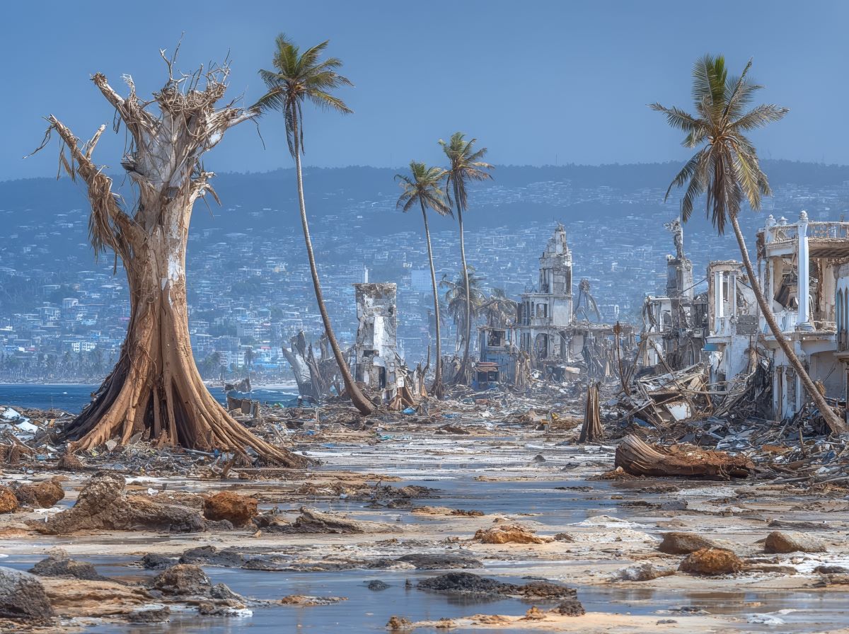
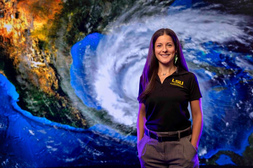
With lasers, smoke and a wind tunnel, UF helps federal agency investigate deadly Hurricane Maria
As Floridians brace for hurricanes amid the wild weather of 2025, some University of Florida researchers have their eyes on 2017’s Hurricane Maria, the deadly Category 4 storm that pummeled Puerto Rico. Engineering professor and natural hazards researcher Brian Phillips, Ph.D., is leading UF’s efforts in a Hurricane Maria investigation conducted by the National Institute of Standards and Technology, known as NIST. The goal is increased safety and resilience amid deadly conditions. Maria killed nearly 3,000 people and caused more than $90 billion in damage. Most of the island’s wind sensors and weather stations failed as the storm raged, leaving responders and investigators with few reliable weather measurements. What went wrong? Phillips and UF storm researchers are helping answer that question — and provide safety and structural recommendations — as part of NIST’s Hurricane Maria investigation. The full report will be released in 2026, but NIST recently published preliminary findings; some of the hazard and structural load data was derived from wind tunnel tests at UF's NHERI Experimental Facility in the Powell Family Structure and Materials Laboratory on UF’s East Campus in Gainesville. “Our wind tunnel has a strong reputation in the wind-engineering community for its unique flow control and measurement capabilities We worked with NIST to develop a test campaign to study the wind conditions Puerto Rico’s mountainous terrain and the resulting loads of critical infrastructure,” said Phillips, a civil and coastal engineering professor with UF’s Engineering School of Sustainable Infrastructure & Environment. “UF,” he added, “has one of the premier research wind tunnels in the country and it enables us to pursue impactful research like this.” As part of the NIST investigation, Phillips and his team created 1-to-3100 scale topographic models of regions in Puerto Rico — about 12 kilometers shrunk down to four meters, Phillips said. They set up those models in the wind tunnel and replicated wind flow over the topography. “These initial tests were designed to understand the influence of the complex topography had on the wind,” Phillips said. Flow was measured using velocity probes and particle image velocimetry (PIV). These topographic model tests were followed by 1-to-100 scale tests on models of two hospitals in Puerto Rico. In addition to surface pressure measurements, the team conducted qualitative flow visualization tests using smoke, lasers, and high-speed cameras. “The capabilities of the UF wind tunnel enabled us to investigate the hurricane winds at two different scales,” said NIST’s lead Hurricane Maria investigator, Joseph Main, “so we could measure how the winds were accelerated by Puerto Rico’s mountainous topography and then how those winds translated into loads on critical buildings.” Maria’s flooding blocked roads to hospitals and shelters. The hospitals themselves were heavily damaged by the storm, NIST reported. Reduced access to healthcare was a major factor in the death toll. “It's good to take a step back,” Phillips said about the overall investigation. “Researchers are approaching the disaster from multiple angles, including the better understanding of the hazard, the performance of critical infrastructure, public response and recovery. “This holistic approach is needed to capture the complete picture and maximize what we can learn from the event. UF's primary contribution was understanding the hurricane wind field and the resulting structural loads, which is a critical piece of that puzzle.” In finding infrastructure vulnerabilities, researchers contend the goal is integrating their findings into design standards for Puerto Rico’s unique topography and building codes. The findings also could be valuable to other storm-prone regions with complex topography. NIST launched the investigation in 2018, noting Hurricane Maria “set off a cascade of building and infrastructure failures across Puerto Rico that had lasting impacts on society, including health care, business and education.” “Our goal is to learn from that event to recommend improvements to building codes, standards and practices that will make communities more resilient to hurricanes and other hazards, not just in Puerto Rico but across the United States,” Main said. The complete report is scheduled to be released in 2026, and NIST noted some findings may change before its release. But in July, NIST released some preliminary findings. They include: Peak wind speeds over flat terrain reached 140 mph. They accelerated to over 200 mph in some areas due to the steep hills and mountains. The mountains also intensified the rainfall, which reached 30 inches in some areas. Only three out of 22 weather stations were fully functional during the hurricane. 95.3% of schools on the island lost power for an average of over 100 days. “One important preliminary finding from the study is that emergency preparations work,” NIST reported. “Businesses, schools and hospitals that took specific measures to prepare before Hurricane Maria were able to resume operations more quickly” said Maria Dillard, NIST’s associate lead Hurricane Maria investigator. Preparations included pre-established emergency plans, designated risk mitigation funds and backup power sources.


Florida renters struggle with housing costs, new statewide report finds
Nearly 905,000 low-income renter households in Florida are struggling to afford their housing costs, according to the 2025 Statewide Rental Market Study, released by the University of Florida’s Shimberg Center for Housing Studies. Prepared for Florida Housing Finance Corporation, the report provides a comprehensive look at the state’s rental housing conditions and is used to guide funding decisions for Florida Housing’s multifamily programs, including the State Apartment Incentive Loan (SAIL) program. “Florida’s strong population growth has collided with limited housing supply, pushing rents beyond what many families can afford,” said Anne Ray, manager of the Florida Housing Data Clearinghouse at the Shimberg Center. “This report helps policymakers and housing providers target resources where the need is most acute — including communities that are experiencing the fastest growth and the greatest affordability gaps.” Key findings from the 2025 study include: A growing affordability gap: An estimated 904,635 renter households earning below 60% of their area median income (AMI) are cost burdened, paying more than 40% of their income toward rent. These households are spread across the state, with 64% in Florida's nine most populous counties, 33% in mid-sized counties and 3% in small, rural counties. Surging population and higher rent and housing costs: Between 2019 and 2023, Florida added more than 1 million households — nearly 195,000 of them renters — driven by in-migration from states like New York, Illinois and California. Despite the addition of more than 240,000 multifamily units, median rent soared nearly $500 per month, from $1,238 to $1,719. After years of growth, Florida's older renter population is holding steady: Renters age 55 and older represent 39% of cost burdened households, up from 29% in 2010 but similar to 2022 numbers. Most renters are working: 79% of renter households include at least one employed adult, compared to 67% of owner households. Most non-working renters are seniors or people with disabilities. Homelessness is on the rise: The report estimates 29,848 individuals and 44,234 families are without stable housing, up from 2022, as hurricanes and tight markets contribute to displacement. Assisted housing provides an alternative to high-cost private market rentals: Developments funded by Florida Housing, HUD, USDA and local housing finance authorities provide over 314,000 affordable rental units statewide. Future risks to affordable housing stock: More than 33,000 publicly assisted units may lose affordability protections by 2034 unless renewed. Evalu ating affordable housing in Florida “State- and federally-assisted rental housing developments are essential to providing stable, affordable homes for Florida’s workforce, seniors, and people with special needs,” Ray said. “Florida Housing Finance Corporation’s programs make up a significant portion of this housing, and our study helps ensure those resources are directed where they’re needed most. Preserving these developments — and expanding them — is critical to keeping pace with Florida’s growing population and maintaining affordability.” Since 2001, the Shimberg Center has produced the Rental Market Study every three years to inform strategic investments in affordable housing across Florida. The study evaluates needs across regions and among key populations including seniors, people with disabilities, farmworkers and others. The Rental Market Study and the Florida Housing Data Clearinghouse are part of a 25-year partnership between the Shimberg Center and Florida Housing Finance Corporation to support data-driven housing policy and planning.

Psychologists introduce third path to a ‘good life’ — one full of curiosity and challenge
For centuries, scholars and scientists have defined the “good life” in one of two ways: a life that is rooted in happiness, characterized by positive emotions, or one that is centered on meaning, guided by purpose and personal fulfillment. But what if there is another, equally valuable path — one that prioritizes challenge, change and curiosity? “We found that what was missing was psychological richness — experiences that challenge you, change your perspective and satisfy your curiosity.” — Erin Westgate, Ph.D., assistant professor psychology, director of the Florida Social Cognition and Emotion Lab This third dimension, which may result in a more psychologically rich life for some, is being explored in a new study — led by University of Florida psychologist Erin Westgate, Ph.D., in collaboration with Shigehiro Oishi, Ph.D., of the University of Chicago. According to their research, some people prioritize variety, novelty and intellectually stimulating experiences, even when those experiences are difficult, unpleasant or lack clear meaning. “This idea came from the question: Why do some people feel unfulfilled even when they have happy and meaningful lives?” Westgate said. “We found that what was missing was psychological richness — experiences that challenge you, change your perspective and satisfy your curiosity.” Westgate and Oishi’s research shows that a psychologically rich life is distinct from lives defined by happiness or meaning. While happiness focuses on feeling good, and meaning is about doing good, richness is about thinking deeply and seeing the world differently. And for a significant minority of people around the world, that third path is the one they would choose — even if it means giving up happiness or meaning. A new way to think about the ‘good life’ According to Westgate and Oishi, psychological richness is defined as a life filled with diverse, perspective-changing experiences — whether these are external, such as traveling or undertaking new challenges, or internal, like absorbing powerful books or pieces of music. “A psychologically rich life can come from something as simple as reading a great novel or hearing a haunting song,” Westgate said. “It doesn’t have to be about dramatic events, but it can shift the way you see the world.” Unlike happy or meaningful experiences, rich experiences are not always pleasant or purposeful. “College is a good example. It’s not always fun, and you might not always feel a deep sense of meaning, but it changes how you think,” Westgate said. “The same goes for experiences like living through a hurricane. You wouldn’t call it happy or even meaningful, but it shakes up your perspective.” Researchers in Westgate’s lab at UF have been studying how people respond to events like hurricanes, tracking students’ emotions and reactions as storms approach. The results show that many people have viewed these challenging experiences as psychologically rich — altering how they saw the world, even if they didn’t enjoy them. The roots of the idea While the study is new, the concept has been years in the making. Westgate and Oishi first introduced the term “psychologically rich life” in 2022, building on earlier research and scale development around 2015. Their latest paper expands the idea, showing that the concept resonates with people across cultures and fills a gap in how people define well-being. “In psychology and philosophy, dating back to Aristotle, there’s been a focus on hedonic versus eudaimonic well-being — happiness versus meaning,” Westgate said. “What we’re doing is saying, there’s another path that’s just as important. And for some people, it’s the one they value most.” While many people ideally want all three — happiness, meaning and richness — there are trade-offs. Rich experiences often come at the cost of comfort or clarity. “Interesting experiences aren’t always pleasant experiences,” Westgate said. “But they’re the ones that help us grow and see the world in new ways.” Westgate hopes the study will broaden how psychologists and the public think about what it means to live well. “We’re not saying happiness and meaning aren’t important,” Westgate said. “They are. But we’re also saying don’t forget about richness. Some of the most important experiences in life are the ones that challenge us, that surprise us and that make us see the world differently.”

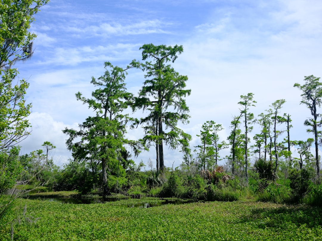
Wetlands: Nature’s First Line of Defense for Our Coast and Communities
Since the 1930s, Louisiana’s coastline has been reshaped by the relentless advance of the Gulf, with over 2,000 square miles of land disappearing beneath its waters and representing the largest loss of coastal land anywhere in the continental United States. This dramatic transformation has far-reaching consequences, threatening local economies, delicate ecosystems, and heightening the state’s exposure to hurricanes. In the face of these urgent challenges, LSU’s College of the Coast & Environment (CC&E) stands at the forefront, leading pioneering research and bold initiatives that not only protect Louisiana’s coast, but also build stronger, more resilient communities. Below are just a few examples of how CC&E is driving meaningful solutions for our coastal future. Wetlands are vital to protecting our coast, and CC&E researchers are actively investigating the role of both constructed and natural wetlands in reducing coastal flooding hazards. Through several projects funded through the US Army Corps of Engineers, Drs. Robert Twilley, Matthew Hiatt, and CC&E Dean Clint Willson, along with collaborators across campus, are conducting research on coastal ecosystem design - a framework that leverages the benefits of natural and nature-based coastal features, such as wetlands, environmental levees, and flood control gates – and how that could be integrated into engineering design and urban planning. Through the State of Louisiana’s ambitious Coastal Master Plan, administered by the Louisiana Coastal Protection and Restoration Authority, wetland construction and restoration play a huge role in managing the Louisiana coastal region. Such innovative techniques leveraging natural and nature-based features require evaluation to determine the success of such projects, and CC&E researchers are using cutting-edge science to advance this endeavor. Dr. Tracy Quirk and her students are investigating the success of marsh restoration by comparing structural and functional characteristics (e.g., vegetation, elevation, hydrology, accretion, and denitrification) between two created marshes and an adjacent natural reference marsh along the north shore of Lake Pontchartrain, Louisiana. Wetlands not only serve as a buffer from storms and sea level rise but also play a major role in regulating greenhouse gas emissions and contribute to productive vibrant ecosystems. In large collaborative project funded by the National Science Foundation, Dr. Giulio Mariotti is using computer models to forecast how coastal marshes may change in size, shape, and salinity in the future, and how these changes could affect methane emissions. As part of the same project, Drs. Haosheng Huang and Dubravko Justic are creating high-resolution hydrodynamic and biogeochemical models to predict changes in methane emissions in coastal Louisiana. In another project, with funding from Louisiana Center of Excellence, National Science Foundation, Louisiana Sea Grant, and the National Oceanic and Atmospheric Administration, Drs. Matthew Hiatt and John White have established a network of sensors to measure water levels and salinity throughout the wetlands in Barataria Bay, Louisiana, a region that has experienced significant land loss and storm impacts. The goal is to establish an understanding of the drivers of saline intrusion in marsh soils, and to ultimately determine what this means for the ecological resiliency of wetlands experiencing rapid change. CC&E’s leadership in wetlands science is recognized nationwide. It is the only college in the United States to have six faculty members—Drs. John White, John W. Day, Jr., Robert Twilley, William Patrick, James Gosselink, and R. Eugene Turner—honored with the prestigious National Wetlands Award. No other institution has had more than one recipient. Presented annually by the Environmental Law Institute, this award celebrates individuals whose work demonstrates exceptional innovation, dedication, and impact in wetlands conservation and education. CC&E’s unmatched record reflects decades of pioneering research and a deep commitment to safeguarding the nation’s most vulnerable coastal landscapes. Every day, CC&E channels this expertise into action—protecting Louisiana’s coast and, in turn, the communities, wildlife, and ecosystems that depend on it. Through bold research, collaborative partnerships, and a vision grounded in science, the college is shaping a more resilient future for coastal regions everywhere. CC&E is building teams that win in Louisiana, for the world. Article originally published here.


Tracking rain patterns will improve hurricane forecasting, UF researcher finds
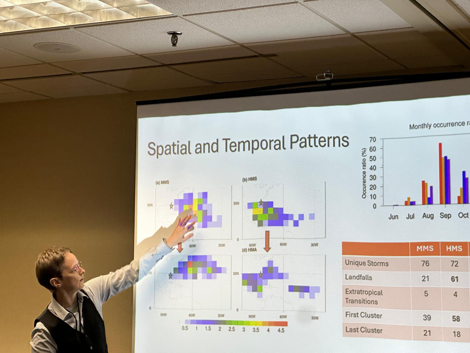
Studying the precipitation patterns in hurricanes may be key to predicting future storm patterns and their potential strength, a University of Florida researcher has found. Supported by a four-year, $212,000 grant from the National Science Foundation, Professor of Geography Corene Matyas, Ph.D. has identified the patterns of rain rates within storms and studied the moisture surrounding these storms. “We are hoping that, if we have a better prediction of moisture availability, that might help us forecast rain events with greater accuracy,” Matyas said. “The more we know about how storms develop, the more we can predict their path and magnitude.” The ideal stage for the perfect storm The potential for devastating high winds, storm surge and flooding poses an annual threat to Florida and its residents. With 1,350 miles of coastline and relatively flat geography that juts out to separate the warm waters of the southeast Atlantic and the Gulf, Florida creates the ideal stage for the perfect storm. Last year broke records with 18 named storms, including 11 hurricanes in the Atlantic basin and three major hurricanes making landfall along Florida’s coast. Early predictions are crucial to hurricane preparedness, allowing for increased response time and resource allocation, and hurricane modeling is essential for understanding these somewhat unpredictable storms. Advances in technology, data collection and the use of artificial intelligence in hurricane modeling have significantly impacted the ability to predict a storm’s path and strength more accurately. Artificial intelligence helps researchers understand hurricanes Matyas has completed two studies on this topic. The first study processed 12,000 images of rain rates from tropical storms and hurricanes in the Atlantic, using a machine learning algorithm called a convolutional autoencoder. Similar in use to image recognition software, the encoder broke the rain rate images down and simplified the patterns. Six main types, or clusters, of rainfall patterns for tropical cyclones were identified. At a presentation of the work to forecasters at the National Weather Service office in Jacksonville, the forecasters confirmed that one of the patterns matches what they typically see when late-season storms make landfall over Florida’s Gulf Coast. The second study used the autoencoder to process 4,600 images that represent the amount of moisture in the atmosphere extending 1,000 kilometers away from each hurricane. “We looked for commonalities in the patterns and found four dominant patterns of moisture that accompany Atlantic basin hurricanes,” Matyas said. “We found the biggest storms with the most moisture make the most landfalls, typically in the Caribbean and even in southern Florida. They also have a large moisture pool, giving them a bigger chance of heavy rainfall.” According to Matyas, three of the moisture patterns found in the second study were strikingly like those found in the earlier study that used fewer observations in a statistical analysis. With this use of AI, researchers can now recognize and understand these moisture patterns better, which can improve predictions about a storm’s intensity, its size and the amount of rainfall that will result from it. Early, accurate storm predictions allow Floridians time to prepare Rapid intensification – when, in a 24-hour period, a storm experiences a sudden drop in pressure and a dramatic increase in wind speed – creates much more of a challenge for forecasters. “We tend to boil down a hurricane to a set of coordinates which track the middle of a storm,” Matyas said. “And the fastest winds do focus there, but the moisture gets pulled from thousands of kilometers away and the system forces the moisture up. That moisture must go somewhere. So, the outer edges of the storm need to be understood more as well.” Matyas hopes these studies will help scientists classify rain patterns more accurately and consistently. Continued funding for research at public universities from federal agencies, such as the National Science Foundation and the National Oceanic and Atmospheric Administration, is essential for helping researchers develop tools to detect and predict severe weather events. Matyas is one of two UF faculty members among 18 national researchers named to the 2025 class of fellows by the American Association of Geographers. Matyas and UF Geography Department Chair Jane Southworth, Ph.D. were honored by the organization for their contributions in biogeography, geospatial analytics, soil science, community geography, climatology and other areas related to geography. “I look forward to this opportunity to contribute to the mission of the AAG in a more formal capacity, continuing to research how weather shapes our spaces and share knowledge of earth systems beyond the classroom and the written word to promote an inclusive society,” Matyas said.

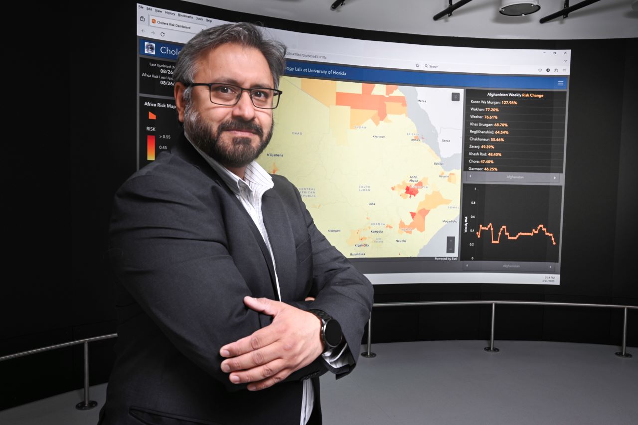
UF professor to expand proven disease-prediction dashboard to monitor Gulf threats
After deploying life-saving cholera-prediction systems in Africa and Asia, a University of Florida researcher is turning his attention to the pathogen-plagued waters off Florida’s Gulf Coast. In the fight to end cholera deaths by 2030 – a goal set by the World Health Organization – UF researcher and professor Antar Jutla, Ph.D., has deployed his Cholera Risk Dashboard in about 20 countries, most recently in Kenya. Using NASA and NOAA satellite images and artificial intelligence algorithms, the dashboard is an interactive web interface that pinpoints areas ripe for thriving cholera bacteria. It can predict cholera risk four weeks out, allowing early and proactive humanitarian efforts, medical preparation and health warnings. Cholera is a bacterial disease spread through contaminated food and water; it causes severe intestinal issues and can be fatal if untreated. The US Centers for Disease Control reports between 21,000 and 143,000 cholera deaths each year globally. Make no mistake, the Cholera Risk Dashboard saves lives, existing users contend. His team now wants to set up a similar pathogen-monitoring and disease-prediction system for pathogenic bacteria in the warm, pathogen-fertile waters of the Gulf of America. “Its timeliness, its predictiveness and its ease of access to the right data is a game changer in responding to outbreaks and preventing potentially catastrophic occurrences.” - Linet Kwamboka Nyang’au, a senior program manager for Global Partnership for Sustainable Development Data Closer to home Jutla is seeking funding to develop a pathogen-prediction model to identify dangerous bacteria in the Gulf to warn people – particularly rescue workers – to use protective gear or avoid contaminated areas. He envisions post-hurricane systems for the Gulf that will help the U.S. Navy/Coast Guard and other rescue workers make informed health decisions before entering the water. And he wants UF to be at the forefront of this technology. “If we have enough resources, I think within a year we should have a prototype ready for the Gulf,” said Jutla, an associate professor with UF’s Engineering School Sustainable Infrastructure and Environment. “We want to build that expertise here at UF for the entire Gulf of America.” Jutla and his co-investigators have applied for a five-year, $4 million NOAA RESTORE grant to study pathogens known as vibrios off Florida’s West Coast and develop the Vibrio Warning System. These vibrios in the Gulf can cause diarrhea, stomach cramps, nausea, vomiting, fever and chills. One alarming example is Vibrio vulnificus, commonly known as flesh-eating bacteria, a bacterium that often leads to amputations or death. The Centers for Disease Control and Prevention (CDC) has reported increases in vibrio infections in the Gulf region, particularly from 2000 to 2018. The warm and ecologically sensitive Gulf waters provide a thriving habitat for harmful pathogens. “The grant builds directly on the success of our cholera-prediction system," Jutla noted. "By integrating AI technologies into public health decision-making, we would not only lead the nation but also become self-reliant in understanding the movement of environmentally sensitive pathogens, positioning ourselves as global leaders.” Learning from preparing early Jutla’s dashboards are critical tools for global health and humanitarian officials, said Linet Kwamboka Nyang’au, a senior program manager for Global Partnership for Sustainable Development Data. “Its timeliness, its predictiveness and its ease of access to the right data is a game changer in responding to outbreaks and preventing potentially catastrophic occurrences,” Kwamboka Nyang’au said. Over the last few years, Jutla and several health/government leaders have been working to deploy the cholera-predictive dashboard. “Our partnership with UF, the government of Kenya and others on the cholera dashboard is a life-saving mission for high-risk, extremely vulnerable populations in Africa. By predicting potential cholera outbreaks and coordinating multi-stakeholder interventions, we are enabling swift action and empowering local governments and communities to prevent crises before they unfold,” said Davis Adieno, senior director of programs for the Global Partnership for Sustainable Development Data. The early warnings for waterborne pathogens also allows the United Nations time to issue early assistance to residents in the outbreak’s path, said Juan Chaves-Gonzalez, a program advisor with the United Nations’ Office for the Coordination of Humanitarian Affairs. “There are several things we do with the money ahead of time. We provide hygiene kits. We repair and protect water sources. We start chlorination, we set up hand-washing stations, train and deploy rapid-response teams. At the community level, we try to inject funding to procure rapid-diagnostic tests,” he said. “We identify those very, very specific barriers and put money in organizations’ hands in advance to remove those barriers.” Eyes on the Gulf In the United States, hurricanes stir up vibrios in the Gulf, posing a high risk of infection for humans in the water. There has been a nearly 200% increase in these cases over the last 20 years in the U.S., according to the CDC. “After Hurricane Ian, we saw a very heavy presence of these vibrios in Sarasota Bay and the Charlotte Bay region. Not only that, but they were showing signs of antibiotic-resistance. Last year, we had one of the largest number of cases of vibriosis in the history of Florida,” Jutla said. Samples from 2024 hurricanes Helene and Milton are being analyzed with AI and complex bioinformatics algorithms. “If there is a risky operation by rescue personnel, not using personal protective equipment, then we would want them to know there is a significant concentration of these bacteria in the water,” Jutla said. “As an example, Navy divers operating in contaminated waters are at risk of infections from vibrios and other enteric pathogens, which can cause severe gastrointestinal and wound infections.” Safety and economics “Exposure to vibrios and other enteric pathogens,” Jutla added, “can disrupt economic activities, particularly in coastal regions that are dependent on tourism and fishing. And vibrios may be considered potential bioterrorism agents due to their ability to cause widespread illness and panic.” In developing the Vibrio Warning System, Jutla noted, he and his team want to significantly enhance public health safety and preparedness along the Gulf Coast. By leveraging advanced AI technologies, satellite datasets and predictive modeling, they plan to mitigate the risks posed by environmentally sensitive pathogenic bacteria, ensuring timely interventions and safeguarding human health and economic activities. “Hospital systems and healthcare providers in the Gulf region will have a tool for anticipatory decision making on where and when to anticipate illness from these environmentally sensitive vibrios, and issue a potential warning to the general public,” he said. “With the potential to become a leader in environmental pathogen prediction, UF stands at the forefront of this critical research, poised to make a lasting impact on local, regional, national and global health and safety.”

How UF researchers are helping Floridians to build resilience
When Hurricane Idalia hit the Big Bend region of Florida in 2023, Jeff Carney and his team were watching. A coalition of architects, planners, and landscape architects led by Carney worked closely with the tiny Gulf island of Cedar Key, which is particularly vulnerable to hurricanes, to prepare for this moment. The researchers had modeled for city officials how a major storm would flood the city’s core services. “Idalia caused flooding exactly where the maps said it would, including city hall, the historic downtown, older homes, and many streets,” Carney said. After the storm, Cedar Key moved city hall to higher ground, as outlined in the plan. And just in time. Barely a year later, Cedar Key was hit even harder by Hurricane Helene. Between the storms, Carney’s group had worked with the city to refine their storm preparation. The new plan focused more on resilience-boosting projects, like improving drainage around the city. Cedar Key finalized their plans just weeks before Helene. “A lot of the projects we put forward in this plan are in the process of seeking additional funding after Helene,” Carney said. A professor of architecture at the University of Florida, Carney directs the Florida Institute for Built Environment Resilience, or FIBER. A research institute in UF’s College of Design, Construction and Planning, FIBER engages with communities to understand how the designs of buildings and cities expose Floridians to risks — not just storms, but also excessive heat, poor air quality, even a lack of health care. FIBER faculty then work with cities to mitigate these hazards. By preparing for emergencies, upgrading buildings, and providing targeted services, communities across Florida are bolstering the resilience of their residents, all with expert help from UF researchers. Preparing to weather big storms That kind of resilience is especially important for some of Florida’s most vulnerable residents. Older and poorer Floridians face higher-than-average risks from natural disasters and other environmental hazards. That vulnerability was apparent in Cedar Key as it weathered the last two hurricane seasons. Centered around aquaculture and tourism, Cedar Key seems in many ways to be thriving. Yet, with the feel of a small fishing village, roughly 13% of its nearly 1,000 full-time residents are considered to be financially disadvantaged, according to U.S. Census data. Poorer residents may also have a harder time walking away from coastal communities devastated by storms. With savings invested into damaged homes and jobs tied to the local area, less-wealthy residents often have no choice but to stay and rebuild. Carney’s team helps people see the opportunities for rebuilding with a clearer vision of a future where rising sea levels are a reality. “You capture people’s attention and excitement when you can offer them options that are not doomsday,” said Carney, who has been working in Pine Island and Matlacha in Southwest Florida’s Lee County to help residents affected by recent storms prepare for the future. “There’s a lot of opportunity for rebuilding as long as you don’t try to have it be business as usual. We help people see how redevelopment can provide a community asset for the future,” he added. “We try to paint the picture of all the possible scenarios so people can find their own comfort level. It puts them in the driver’s seat.” Aging with fewer choices While that kind of agency is empowering, it can be harder to come by as people retire and find themselves facing tough decisions on fixed incomes. That’s a common experience in Florida, which has a larger proportion of seniors than any other state, due in part to its popularity as a retirement destination. More than 10% of Americans over the age of 65 live below the federal poverty line. This population often finds themselves moving to less safe places as they age. “Older people with more social vulnerability — such as low income or poor health — have a tendency to move to worse places,” said Yan Wang, Ph.D., a professor of urban and regional planning in the UF College of Design, Construction and Planning. “They are more likely to move to places with less economic stability, with less access to health care, and with more exposure to extreme weather.” Wang and postdoctoral researcher Shangde Gao, Ph.D., recently published a study that uncovered the risks low-income seniors face when moving. Compared to their peers with higher incomes, poorer seniors were more likely to end up in neighborhoods lacking access to health care facilities. To address these kinds of disparities, UF Health has launched mobile health units that can reach people who have trouble traveling to health centers, including low-income seniors. The Mobile Outreach Clinic provides primary care and referrals for specialists. And the newly launched cancer screening vehicle, which serves all of North Central Florida, can help catch the disease in the early stages when it is easiest to treat. It’s not just finding health care that’s a struggle. Older adults from minority racial groups were also more likely to increase their exposure to poor air quality and to natural disasters like flooding and hurricanes when they moved, Wang and Gao discovered. “If we understand the trend and causes of these income disparities better, we could better prepare some places with more health care resources or better hurricane preparation for these older populations,” Wang said. Building safer, healthier homes That preparation is happening right now in Jacksonville, not just for big storms but for the everyday nuisances and hazards — even the ones people are exposed to in their own homes — that threaten people’s lives and health. The Jacksonville Restore and Repair for Resiliency research initiative was founded to address these kinds of risks while improving energy efficiency. The R3 initiative, as it’s known, is a home remodeling program organized by a slew of community partners and supported by FIBER research on the impact of housing quality on health. The project aims to keep longtime residents of the Historic Eastside in their homes while addressing the home hazards that put people at risk for medical complications like asthma attacks and emergency room visits. “The designs of buildings impact human health and well-being,” said Lisa Platt, Ph.D., the lead researcher with the Jacksonville program and an assistant professor of interior design with FIBER. “Our research is helping the team prioritize the home improvements that will benefit residents’ health the most.” Jacksonville’s Eastside faces a lot of challenges. The population is older than the city as a whole. Roughly three-quarters of residents are over the age of 60, and the poverty rate is over 40%. Yet more than a third of residents own their own homes. Often passed down from previous generations, some of the houses are now over a century old and struggle to keep the intense Florida heat and humidity out. Platt’s research has modeled how things like high heat days — only growing more common in a warming world —are associated with increased emergency room use and poor perceived physical and mental health. That science helps guide the community partners to prioritize providing air conditioning and better insulation to protect Historic Eastside residents. To date, the Jacksonville program is targeting up to 70 homes for renovation. Builders have fixed holes in roofs, replaced drafty windows, and hooked up air conditioning for the first time, keeping the heat and humidity at bay and protecting residents’ health. Now the R3 initiative is applying for federal grants to expand the program. “I think the best way to approach this kind of community action research is with humility and outreach. Community members have amazing expertise. I always say, ‘I can build models to analyze the problem, but you are the ones that are the experts,’” Platt said. “That’s where UF can be most useful, is coming in from a perspective of service.”
How LSU is Helping Keep Louisiana at the Center of the Nation’s Seafood Map
1. Strengthening the Seafood Workforce Through outreach programs like Louisiana Fisheries Forward, a partnership between Louisiana Sea Grant and the Louisiana Department of Wildlife and Fisheries, LSU helps fishers and processors modernize their operations. These voluntary programs teach best practices in handling, traceability, and sustainability — directly improving product quality and market reputation. LSU’s extension agents also provide hands-on disaster recovery assistance after hurricanes and market disruptions, helping ensure Louisiana’s seafood workforce remains resilient and ready for the next season. 2. Building Seafood Resilience The total economic value for oysters in 2018 was more than $180 million. Resilience defines LSU’s seafood science. Researchers at the LSU AgCenter and Louisiana Sea Grant are leading selective breeding programs and developing genetic tools to combat disease, temperature changes, and salinity stress. With a powerful combination of hatchery capacity, genetics expertise, and industry collaboration, LSU is helping Louisiana’s seafood industry adapt faster and smarter — protecting both the food supply and the economic backbone of coastal communities. 3. Powering Economic Growth Every part of LSU’s seafood research and outreach ties directly to Louisiana’s economy. AgCenter economists analyze market data and advise state and federal partners on strategies to grow the seafood sector. Meanwhile, Sea Grant specialists help entrepreneurs develop value-added seafood products, from branded lines to ready-to-eat options, that increase profit margins and create new jobs in coastal towns. By helping Louisiana seafood businesses stay competitive, LSU keeps more of the industry’s economic benefits right here at home. 4. Supporting Communities Louisiana’s seafood industry faces constant challenges. LSU’s coastal extension agents and Sea Grant programs provide on-the-ground support to help communities recover and rebuild after disasters. Whether assisting with dock repairs, connecting fishers to relief programs, or helping restart operations, LSU’s commitment ensures that Louisiana’s coastal workforce can weather any storm. 5. Preparing the Next Generation LSU’s work extends from the lab to the dock — and into the classroom. New research and education programs are training future scientists, producers, and entrepreneurs to continue Louisiana’s seafood legacy. For new LSU students interested in the coast, Bayou Adventure, a trip created by the College of the Coast & Environment (CC&E), was designed specifically to educate incoming freshmen about some of the challenges and marvels of the Louisiana coastline. The trip stops at sites that showcase "not just the significance of these areas to the state and nation, but the important work that is being done to sustain and preserve them," said Clint Willson, dean of CC&E. Through workforce development, hands-on learning, and applied research, LSU is shaping the next wave of innovators who will protect Louisiana’s coast and ensure its seafood remains world-renowned. Looking Ahead As the seafood industry faces new challenges and opportunities, LSU’s mission remains clear: to protect Louisiana’s coast, empower its seafood workforce, and ensure the state remains synonymous with the best seafood in America.
LSU Hurricane Expert Dr. Jill Trepanier Featured in TIME Magazine
For the first time in a decade, no hurricanes have made landfall in the United States through the end of September—a rare and welcome reprieve for coastal communities. But according to LSU hurricane climatologist Dr. Jill Trepanier, the season has been far from quiet. In a recent TIME Magazine feature, Trepanier explains that while no major storms have struck land, powerful systems have still formed over the Atlantic. “There are storms,” she says. “They’re just not making landfall.” Trepanier points to several atmospheric factors behind this pattern, including dry air moving in from the Sahara and a persistent high-pressure system over the Gulf of Mexico that has made conditions unfavorable for hurricane development near the U.S. coast. Another key influence, she notes, is a pressure pattern called the North Atlantic Oscillation, which helps steer storm paths. “When that oscillation pattern shifts closer to Bermuda, it unfortunately drives them directly into the Gulf Coast and the eastern seaboard,” Trepanier says. “It changes over the course of a handful of years, and then back again. It’s this controlling mechanism that has shifted, thankfully, in the favor of those of us at the coast.” Read the full article here:
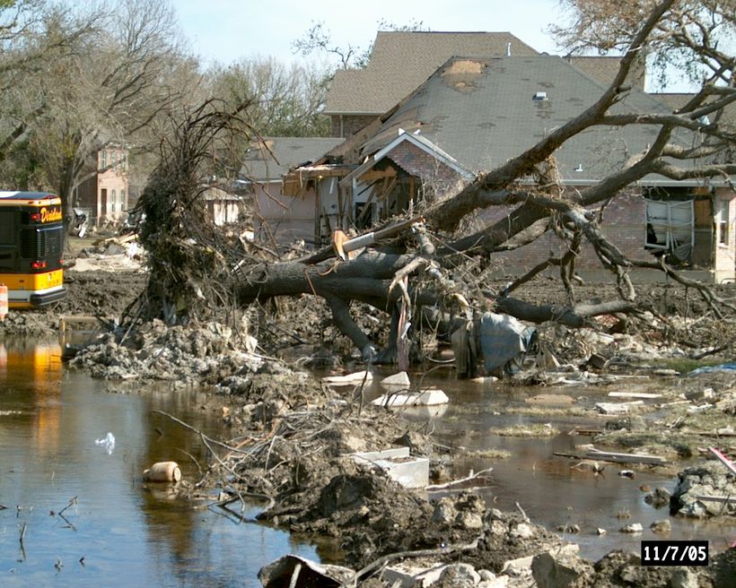
Twenty years ago, Hurricane Katrina hit the southeastern coast of the United States, devastating cities and towns across Louisiana, Florida, Mississippi, Alabama and beyond. The storm caused nearly 1,400 fatalities, displaced more than 1 million people and generated over $125 billion in damages. Rob Traver, PhD, P.E., D. WRE, F.EWRI, F.ASCE, professor of Civil and Environmental Engineering at Villanova University, assisted in the U.S. Army Corps of Engineers' (USACE) investigation of the failure of the New Orleans Hurricane Protection System during Hurricane Katrina, and earned an Outstanding Civilian Service Medal from the Commanding General of USACE for his efforts. Dr. Traver reflected on his experience working in the aftermath of Katrina, and how the findings from the investigation have impacted U.S. hurricane responses in the past 20 years. Q: What was your role in the investigation of the failure of the New Orleans Hurricane Protection System? Dr. Traver: Immediately after Hurricane Katrina, USACE wanted to assess what went wrong with flood protections that had failed during the storm in New Orleans, but they needed qualified researchers on their team who could oversee their investigation. The American Society of Civil Engineers (ASCE), an organization I have been a part of for many years, was hired for this purpose. Our job was to make sure that USACE was asking the right questions during the investigation that would lead to concrete answers about the causes of the failure of the hurricane protection system. My team was focused on analyzing the risk and reliability of the water resource system in New Orleans, and we worked alongside the USACE team, starting with revising the investigation questions in order to get answers about why these water systems failed during the storm. Q: What was your experience like in New Orleans in the aftermath of the hurricane? DT: My team went down to New Orleans a few weeks after the hurricane, visited all the sites we were reviewing and met with infrastructure experts along the way as progress was being made on the investigation. As we were flying overhead and looking at the devastated areas, seeing all the homes that were washed away, it was hard to believe that this level of destruction could happen in a city in the United States. As we started to realize the errors that were made and the things that went wrong leading up to the storm, it was heartbreaking to think about how lives could have been saved if the infrastructure in place had been treated as one system and undergone a critical review. Q: What were the findings of the ASCE and USACE investigation team? DT: USACE focused on New Orleans because they wanted to figure out why the city’s levee system—a human-made barrier that protects land from flooding by holding back water—failed during the hurricane. The city manages pump stations that are designed to remove water after a rainfall event, but they were not well connected to the levee system and not built to handle major storms. So, one of the main reasons for the levee system failure was that the pump stations and levees were not treated as one system, which was one of the causes of the mass flooding we saw in New Orleans. Another issue we found was that the designers of the levee system never factored in a failsafe for what would happen if a bigger storm occurred and the levee overflowed. They had the right idea by building flood protection systems, but they didn’t think that a larger storm the size of Katrina could occur and never updated the design to bring in new meteorological knowledge on size of potential storms. Since then, the city has completely rebuilt the levees using these lessons learned. Q: What did researchers, scientists and the general population learn from Katrina? DT: In areas that have had major hurricanes over the past 20 years, it’s easy to find what went wrong and fix it for the future, so we don’t necessarily worry as much about having a hurricane in the same place as we’ve had one before. What I worry about is if a hurricane hits a new town or city that has not experienced one and we have no idea what the potential frailties of the prevention systems there could be. Scientists and researchers also need to make high-risk areas for hurricane activity in the United States known for those who live there. People need to know what their risk is if they are in areas where there is increased risk of storms and flooding, and what they should do when a storm hits, especially now with the changes we are seeing in storm size.

